


Guangzhou Municipal Planning and Natural Resources Bureau issued a notice: "Planning for Pedestrian Routes in Guangzhou Around the Old and New Central Axis" in order to solicit public opinions.
According to the plan, a pedestrian sightseeing trail named "Yuehuan" will be built to connect the old and new central axis of Guangzhou. This pedestrian sightseeing trail connects the new central axis pedestrian sightseeing trail, the riverside green road, and the traditional central axis path end to end with a “cloud road”.
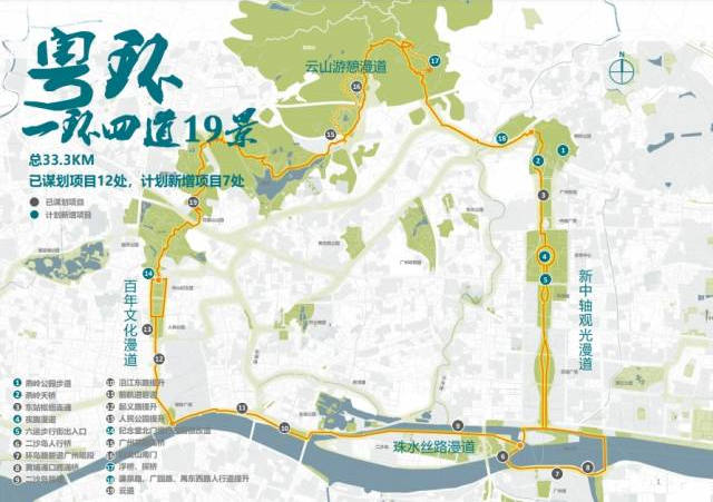
The "Yuehuan" is 33.3 kilometers long and is the best route for one-day hiking. It will set up 19 nodes, including 17 parks and green spaces along the route, 6 commercial districts and 21 national cultural relics protection units. The walking sightseeing trail will also design four themed trails, including the new central axis sightseeing walkway in the city center, the waterway walkway that surrounds the Pearl River, the cultural walkway in the old city, and the walkway through Baiyun Mountain.
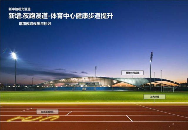
There will be night running facilities and signs added to the sightseeing promenade along the new central axis to facilitate night running for citizens.
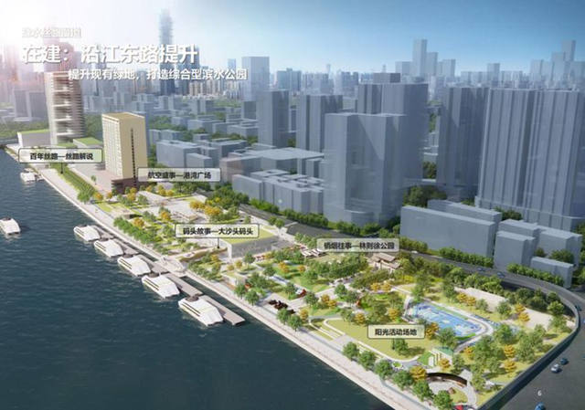
The waterway walkway will transform the existing green space and create a comprehensive waterfront park.

Along the cultural walkway, Uprising Road will be transformed to restore the traditional style of arcade architecture.
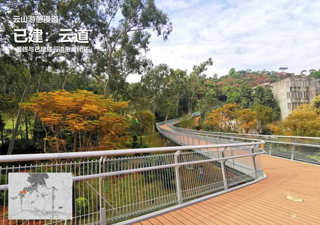
The walkway through Baiyun Mountain will form a closed loop with the already built Yundao.
At present, the "Yuehuan" has completed 1 node, and 7 new projects are planned. Among them, the Yanling Forest Trail, the sports center night track, and the street optimization of the north gate of the memorial hall will be constructed in the near future. Yanling Sky Bridge, Floating Bridge Exploration Bridge Project, and Liuyun Pedestrian Street's underground entrances and exits will be constructed in the near future.
Author | Alice
Editor | Jerry
